
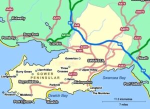
Not having visited Wales for ten years we now made our second trip in two. This time though it was south, with the intention of hiking on The Gower Peninsular, using Swansea as our base.
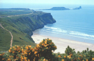
 The Gower Peninsula (Penrhyn Gŵyr) is in South Wales and covers an area of about 70 square miles (180 km2). It projects westwards into the Bristol Channel and is the most westerly part of the historic county of Glamorgan. In 1956, Gower became the first area in the United Kingdom to be designated an Area of Outstanding Natural Beauty.
Prior to the event we were all shocked to hear that Geoff would be absent. In the previous October he fell badly on some wet steps while visiting the Lake District. The result was very painful and later diagnosed as a dislocated coccyx and damaged hip flexor muscles.
During the lengthy recovery period the injuries made it difficult to walk long distances and, more importantly, meant that he could not sit driving for hours.
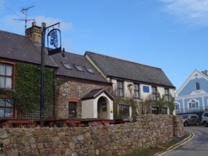
Graham Hicks agreed to take on the task of arranging the accommodation and booked us in at the Tudor Court Hotel, located on the main sea front road leading out of the town towards Swansea Bay.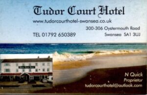
In addition to Geoff there were last minute cancellations by Drew, who was suffering from a nasty cold, and Phil due to family reasons.
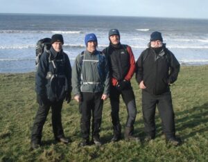
In the end, as a result of the cancellations, there were only four hikers on Friday and Sunday, and five on the Saturday, the lowest number since the Leicestershire Round in 1995, when there were also only five.
Malcolm and Graham B drove down separately and met at the hotel at about 6pm. It was busy but most of the other occupants were there for work, so would be leaving early on Friday and more importantly, vacating the car parking spaces in front of the hotel. Just as well, because our cars were parked in a nearby street and needed to be moved before 8am.
They then went for a meal in the Sea Beach pub where they were joined by Martin and Simon. Afterwards they all checked out the vicinity and booked a Chinese restaurant for Friday evening. When it came to picking an Indian restaurant for Saturday night they were spoilt for choice as, while walking along one of the nearby main roads, they were surprised to see so many Indian Restaurants and take-aways – and most of the shops in between them were barbers. It seemed a strange combination. Eventually they found three next to each other, which appeared to be arranged in order of price – so they chose the one in the middle.
Friday
 We were up early to move cars from the street onto the hotel forecourt, an interesting manoeuvre as the hotel was on a dual carriageway and there was a high kerb with just a few gaps in it. Breakfast at 8am was served with great speed and keenness by the kitchen staff – they were used to guests who needed to get off to work so they had a set “full English” menu and if you weren’t fast enough, that was what you got, regardless.
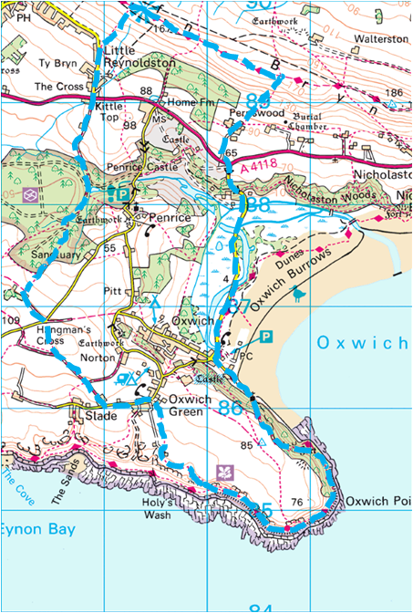
The weather was dull, mild, misty and wet, but not actually raining as we set off on our half hour drive to Oxwich about 13 miles away. The rapid turn-round at breakfast meant that we had arrived at the car park by Oxwich beach at about 9am. As it was going to be muddy, and with rain likely later on, we put on waterproof trousers and gaiters – although there were different opinions as to which should be worn on the outside.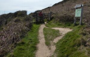
We set off heading south east climbing through the woods and up to Oxwich Point, where an Oystercatcher and Shag were sighted.
We followed the path south west and then north west before taking another inland, heading roughly north towards Oxwich Green. When we reached the minor road we turned left and shortly before Slade we turned right onto a broad muddy track heading north west. We crossed the road ahead and continued a short way to Bryn Sil where we stopped.
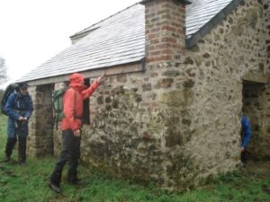 We found a stone-built cottage that was in the process of being renovated. The owner had fixed a good slate roof and repaired the stonework and pointing, but hadn’t yet got round to adding doors or windows. We went in and had lunch, and to get out of the intermittent drizzle. Malcolm had nuts and raisins followed by a banana and coffee. Martin and Simon were, as usual, well provided-for by Mrs Hime, and Graham discovered why Tesco Value meat pies are so cheap.
After lunch we pressed on, heading roughly north, through the woods on a broad track. We met the A4118 and crossed over to continue hiking along the minor road to Little Reynoldston. From there we took the path north east, climbing to the ridge where we turned east and walked a short distance to the viewpoint.
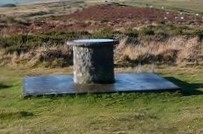 At the viewpoint there was a toposcope, where we spent some time trying to identify the notable landscape features than were marked, but without much luck due to the poor weather.
As we continued south east along the ridge it started to rain and gradually got much heavier as we took the path south west, down to Perriswood. The lower part of the descent was over very boggy ground and the downpour made it a thoroughly unpleasant experience.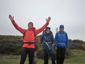
From Perriswood we continued to the A4118 and then south along the road back to the cars at Oxwich. During this final leg the weather conditions started to improve and we could even see Penrice Castle through the trees. We had hiked about 8 miles.
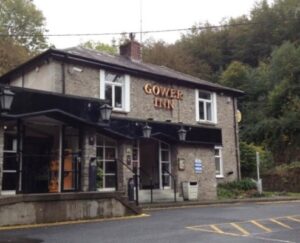 Driving back to Swansea we stopped off at the Gower Arms for a very welcome cup of tea. Back at the hotel Graham and Malcolm managed to negotiate some drying space for our wet clothes in a room behind the kitchen and laundry.
Peter, Laurie and Graham H had arrived and checked in. Graham was planning to hike on Saturday and return home on Sunday morning, while Peter and Laurie had travelled down to be sociable, but would also return home on Sunday morning. Peter had decided he was not fit enough to walk and Laurie was still recovering from an operation to replace a heart valve that had not quite gone to plan.
Once we had cleaned up and changed we all went to the local Wetherspoons (The Potters Wheel) to catch up on each other’s news before our Chinese meal in the Fortune 88. It wasn’t busy, so Peter chatted up the staff and, having had better luck than in Rhyl, announced that he had negotiated a special rate for us. Apart from Laurie, who had Singapore Noodles, we all had the set menu. The food was good and we had an enjoyable time despite there being an initial dispute about the bill and what had actually been agreed in the earlier discussions.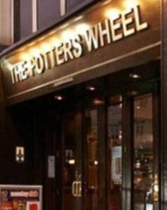
After the meal Malcolm then went back to the hotel and bed and the rest of us found another pub for another drink.
Saturday
There was a much slower start to the day. With no weekday workers at the hotel, we did not have the car problem and breakfast was much more relaxed. Unfortunately leaving our waterproofs in a cold storeroom had not been a success as they would have been drier if we had left them in our room overnight.
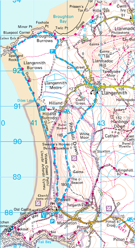 Peter and Laurie went off do some sightseeing and to visit some local churches and graveyards. They did though plan to meet up with the rest of us for lunch in the King’s Head at Llangennith. Graham H was however going to hike and the five of us set off to Rhossili, and left the cars in the National Trust car park.
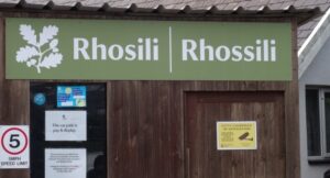
There was some debate as to whether Rhossili was the furthest west that we had ever started a Winter Hike, the other candidate being Malaga in Spain. Malcolm later checked, with the help of Wikipedia and discovered Malaga is at a longitude of 4º25’12”W and Rhossili is at 4º17’13”W. Still, it was the furthest west of the UK Winter Hikes.
The weather was much better than on Friday. We walked through the town and down to the Wales Coastal Path, which officially covers in total, an amazing distance of 870 miles. As we followed the path at the base of the cliffs we spotted some Choughs (pronounced chuff), the rarest member of the crow family. There is only a small population of these birds in the UK with three quarters of them living in Wales and often spotted in coastal areas.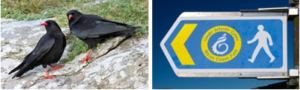
Where the path started to veer inland we dropped down onto the beach. The skies cleared and the sun came out. With firm sand underfoot, a bracing breeze and spectacular views of Worm’s Head and Burry Holms rocks at either end of the bay it felt good to be alive.
 As we progressed towards the Spaniard Rocks at the north end of the bay we rejoined the coastal path that had skirted Hillend before coming down to the beach. Once we reached the Rocks we spent a while checking to see if we could get across to Burry Holms but the tide was not yet far enough out and it was still an island.
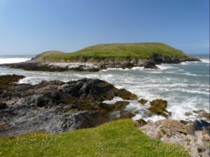
We continued on the path heading roughly east through the dunes and admiring the caravan parks. Near Twic Point, where the path headed slightly inland we branched off and made our way to the nearby car park. We were making good time so Malcolm, Martin and Simon decided that they would carry on via Llanmadoc Hill, while the two Grahams took the direct route by road. The exact route to the top of the hill is not known but Martin recalls the ascent being pretty steep and the usual climbing of the trig point.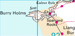
 By five past one we had all arrived at the King’s Head in Llangennith where we met up with Peter and Laurie.
Lunchtime was not without incident. As we struggled with the cryptic crossword in the “I” newspaper, Martin discovered the difference between ordering a Gower Power (drink) and a Gower Power Burger (food), Peter managed to spill some of his Gower Power (drink) and Graham B and Malcolm both managed to knock over vinegar bottles that left them smelling slightly malty.
After lunch we left Peter and Laurie to start making our way back to Rhossili. We headed south along the road and then roughly south west along the path towards Rhossili Down. We climbed up to the ridge and followed the path south.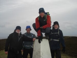
It was still dry and bright, but the wind was extremely strong. (In fact we had been a bit surprised that there were no hang-gliders to be seen.) We went past the remains of an early wartime radar station, built in 1942 before reaching the trig point at The Beacon. We descended into Rhossili and returned to the cars, having completed another 8 miles. It had been a good day’s walk in beautiful scenery and good weather, but a shame there had only been five of us.
The Gower Arms had been so nice the previous day that we stopped off there again for hot drinks, and where Malcolm, still suffering from dropsy managed to spill the milk.
Back at the hotel we cleaned up and paid our bills. As we had booked four rooms and only used three we managed to negotiate paying for just one night for the unused room. It was then off for pre-meal drinks at the Robin Hood, a traditional local pub which didn’t have any cask ale and appeared to be full of people who, if they hadn’t already had too much to drink, were certainly heading that way. Peter and Laurie told everyone about their day and their visit to The Mumbles as well as Rhossili, and we made another attempt at the fiendish crossword.
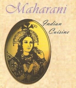 We then made our way to the Maharani restaurant for 7pm. Graham B was the only one having a starter, so he got his order in early to save time. Little did we realise that our mains would take more than an hour to appear! There would have been plenty of time for a haircut, accounting maybe for the preponderance of barbers.
We used the time to have an impromptu planning meeting and arrived at some far-reaching decisions, the main ones being:-
- All future AHST hikes (new name needed from 2019) will be on the last full weekend in January.
- In 2017 it will therefore be 26/29th January, with The Peak District being the location and with Laurie organising the B&B in Buxton.
- 2018 (The 50th anniversary hike) will be on 25/28th January. As the first hike in 1968 and the first winter hike in 1969 visited Leith Hill and Box Hill respectively both in Surrey, it was decided that we should revisit both.
- After the 2018 hike Graham B would stop being responsible for its organisation, and the infamous Points Table would be terminated.
- From 2019 we will have a base town and a range of activities so, for example, any of us might do a hard or easy walk one day and visit a museum the next, and perhaps all take turns in organising the various parts of the weekend. The important thing is that we keep the annual event going, meeting up each evening for fine food, fine drink and fine conversation.
After this we noticed:
- An elderly chap sitting at the back of the restaurant, just drinking whisky.
- Some people returning take-away meals with complaints that they had been given the wrong food.
- We were very hungry.
When our food eventually turned up, at 8.15pm., it was quite good (apart from the chapattis which were not cooked properly) so we ate up, paid and left. Some of us returned to the hotel and some of us went to the Sea Beach pub.
Sunday
Breakfast was at 8am, after which we said our goodbyes to Peter, Laurie and Graham H who were heading back home. The four of us who were left finished our packing, checked out and drove out of Swansea and along the A465 Head of the Valleys road to Ystradfellte, on the South-East edge of the Brecon Beacons. It was very roughly on our way home.
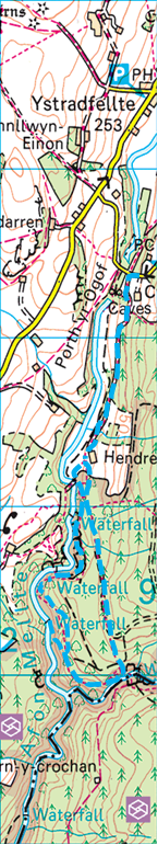 We planned to follow the well laid-out route which took in four waterfalls on the Afon Melite (River Melite). The river derives its name from Mellt – the Welsh word for ‘lightning’ – after its tendency to rise and fall rapidly in response to heavy rainfall. We arrived at the Four Waterfalls Car Park at 9.45am.
The bad news was that it was raining. The good news was that the car park machine wasn’t working. The really bad news was that by the time we had kitted up (including umbrellas for Graham and Malcolm) the warden had arrived so we had to pay after all.
However, after the wet winter and recent heavy rain the rivers were full, and with there being very few people about it appeared to be an ideal time to see waterfalls.
We set off, on the access path to the waterfalls, heading south on what was to be an elongated anti clockwise loop. With no leaves on the trees the visibility was excellent.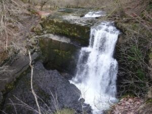
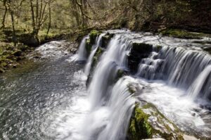
The first waterfall (Sgwd Clun Gwyn [Fall of the White Meadow]) was a spectacular sight and sound.
To reach the second waterfall (Sgwd Isaf Clun Gwyn [Lower Fall of the White Meadow]) we went down a steep slope with steps and when we arrived we watched a group wearing wetsuits, helmets and buoyancy aids jumping off the rocks into the churning water below the falls. It was all as equally spectacular as the first.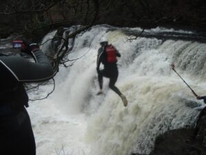
To reach the third waterfall (Sgwd y Pannwr [Fall of the Fuller]) we had to leave the main loop that involved a steep there and back path (NE down & SW back). At the waterfall there was another group similarly equipped, preparing to go over the falls in canoes.
At the last waterfall (Sgwd Yr Elra [Fall of the Snow]) the water poured off a ledge, with the path below allowing us to walk behind the cascade and spray.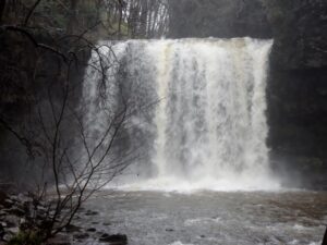
To complete our 4 mile round trip, back to the cars, we headed roughly North with the first part being very boggy and requiring several detours.
It had all been very picturesque and exhilarating and a great way to end a most enjoyable weekend, during which it had been noted that this was the first Winter Hike where all the participants were over 50 years old.