
Geoff’s presence in 1987 had been so sorely missed that we decided to pick him up on route to the start of this years hike. Also returning was Peter, but absent were Drew Rush; who offered an excuse of being in Australia, at the World Scout Jamboree, and Martin Hime.
So, on the Friday evening, seven of us travelled down to Geoff’s home, located between Holmbury St. Mary and Forest Green, at the south end of Surrey and to the South West of Leith Hill. Geoff loaded his gear into the van and Malcolm D continued to drive south, just over the county boundary into West Sussex, and onto The Dog and Duck pub just past Kingsfold.
After a couple of drinks we asked the landlord if he knew of anywhere we could camp, and were pointed in the direction of an old football pitch behind the pub. It must have been years since it had last seen a game as it was being used as a bit of a dumping ground. Despite being badly chewed up and very lumpy we managed to find a fairly smooth spot to put up the tents.
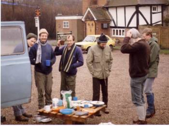
On the Saturday morning we did something we had never done before. We returned to the pub car park and set the Primus stoves up in the back of the van.
We stood around eating breakfast, using an old pallet as a table.
With our stomachs full we cleared away, locked up the van and set about starting the hike. The weather though was not so good – it had been a fairly wet month and it started to rain soon after we got underway.
Initially we followed the footpath east, crossing the railway before meeting a minor road. Here we followed the road north-east, through the village of Langhurst until we met the footpath just to the south of Great Benhams Farm.
From here it we continued across fields in an easterly direction towards Rusper.
The rain was relentless and everything was so wet that some of us got electric shocks from just touching the wooded posts as we crossed electric fences.
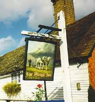 The footpath came out just to the south of the town so we followed this into Rusper, where we found The Plough, our lunchtime stop.
By now we were all soaked through. However, the pub was very hospitable and we were shown to a room with a roaring fire, where we steamed ourselves dry.
Following some light refreshment and with the rain starting to ease, we decided to set about the afternoon session. We left the pub and headed north-west along the road.
We soon arrived at Waffle Corner, a major bend in the road, and the location of the county boundary. Instead of following the road west we took the footpath into Surrey and continued heading north-west in the direction of Clark’s Green.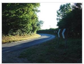
However, before arriving there, at Pleystowe Farm, we turned north, staying on the footpath until we reached Capel. It was here that we had decided to spend the night.
We camped on the edge of a muddy sports field behind the pavilion / youth club. With the rain getting much lighter we set up the tents. The evening meal was, as usual, beef curry, which on this occasion had added chilli, courtesy of Graham.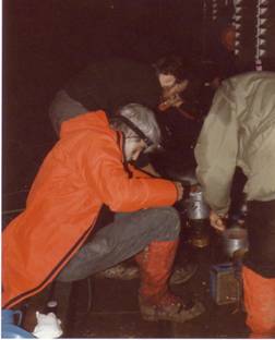
The evening was spent in The Crown. One group of us played the quiz machine for most of the evening – so much so, that it started to break, with the answers just flashing on the screen. Nevertheless we continued to beat it until it finally gave up.
We stayed until closing time and as we made our way back to the tents we disturbed a couple using a bench close by.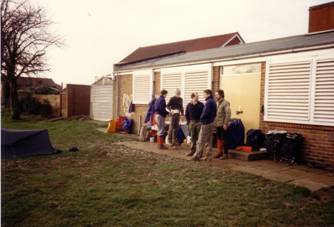
By morning it had stopped raining. We had breakfast and packed up. As we stood around outside the pavilion we took stock of the situation and prepared ourselves for the day ahead.
Our first challenge was to get back across the railway and also the A24 – fortunately we were able to follow a footpath north-west that achieved both these objectives. We continued north on the footpath through a wooded area and then took a minor road to Minnickfold. It was then back onto a footpath and a steady hill climb to Coldharbour, the highest village in South East England.
By now it was time for lunch so we found the PH (The Plough) that was clearly marked on the map.
After a short break we were ready for the final assault – the top of Leith Hill.
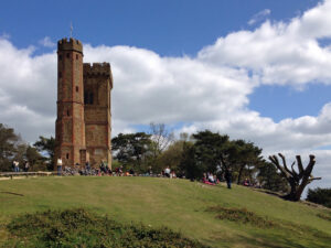
Shortly after leaving the pub we found the footpath that led through the wooded common, steadily up the hill to the tower.
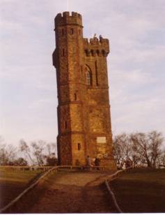 This fortified folly was built in 1765 by Richard Hull of Leith Hill Place and given to the National Trust in 1923 by Mr W J MacAndrew.
Upon arrival Malcolm D and then Curly tried to show off their climbing ability by scaling the outside of the tower.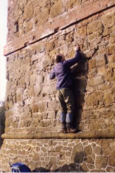
They were, however, eventually convinced to take the stairs, like the rest of us, which led to top on the 1,029ft structure.
At the top we asked another visitor to take our group photo.
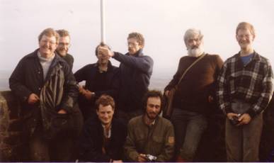 Despite the slightly murky day we then spent some time enjoying the ‘unrivalled’ panorama. It is said that on a clear day it is possible to see 13 counties and even St Paul’s Cathedral in central London.
After this pleasant experience there was still more fun to come – the descent of Leith Hill.
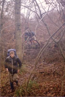 Our route down meant fighting our way through the fallen trees from the hurricane that had hit most of Britain the previous October.
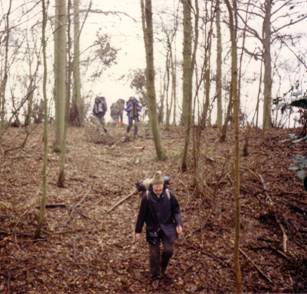
We finally met Tanhurst Lane and were only just around the corner from Geoff’s home. The group in front followed the road round, but those with Geoff, a bit further back, took a short cut and arrived at the house first.
Whilst we waited at the house, Geoff drove Malcolm D back to The Dog and Duck to collect the van. It was not long though before we were on our way back to London, pleased that the poor weather had not spoilt what was a most enjoyable weekend.