
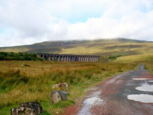
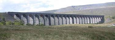
At the planning meeting for this year’s hike consideration was given to making this our second international event, with a trip to France. However, in order to obtain cheap flights we would have needed to book quickly and as some of us could not commit to a specific date so early, we decided to complete the 3 peaks we started in 2001. It was therefore back to Settle in North Yorkshire, where we once again stayed at Whitefriars B&B. On the Friday morning our destination was the summit of Whernside. We parked at the Ribblehead Viaduct, a popular tourist attraction in it’s own right, and prepared ourselves for the day ahead.
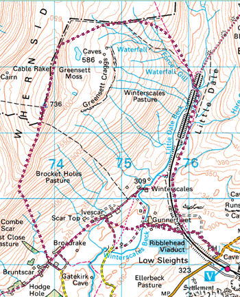
We followed the footpath to the railway and then along the east side of the track. Graham spotted an Ermine but by the time everyone else looked it had gone.
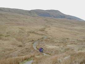
After about a couple of kilometres and just before the track entered a tunnel the path crossed the railway and then continued round until it reached the summit ridge.
As we climbed and looked back we had an excellent view to the south of Ingleborough, one of our climbs from 2001.
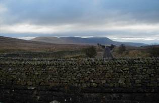
We took shelter behind the wall and ate our lunch.
The strong wind continued, and some snow was experienced as we moved south along the Whernside summit ridge.
Here we turned east and followed the path back towards the viaduct that carries the Settle to Carlisle Railway. This most impressive structure with its 24 massive arches, standing 104ft above the moor, was built in 1875 and restored in 1991.
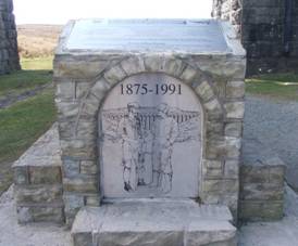
There is much evidence relating to the building of the viaduct, including a memorial under the viaduct itself, to the many builders that lost their lives during its construction. Indeed the loss of life was so great that the railway company paid for an expansion of the local graveyard.
After the magnificent meal we had had in 2001 there was no doubt about where we were going to eat – The Golden Lion. So some of us dashed off to book a table and at the same time asked if they could recommend anywhere for Saturday night.
They suggested a Bangladeshi restaurant and even showed us where it was. We went and booked a table there and found that we could take our own alcohol.
We returned to the Golden Lion for a quick drink before going back to the B&B to meet the others, including Peter Cox who had once again turned up to visit us.
Back at the Golden Lion we were pleased to discover that there had been no decline in it’s standard – we all thoroughly enjoyed our meals. There was even a little light entertainment, with a fairly large group of ‘thirty something’ celebrating a birthday.
After our meal we moved to the bar area, found a table and played cards for the rest of the evening.
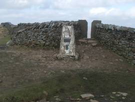
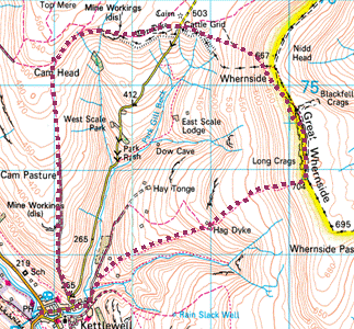
Saturday We had planned a route for Saturday that was about half a mile shorter than Friday, and included a climb to Great Whernside. A bit of a misnomer, as it’s height is less than that of Whernside.
After breakfast we left Peter, who was going to have a look around the town, and set of for Kettlewell, the setting for the film ‘Calendar Girls’, where we parked close to the river.
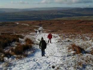
It was a hard climb, especially as there was a very strong head wind.
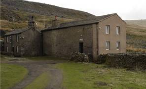
About half way we came across Hag Dyke, an old farmhouse that is now a Scout Hostel administered by the 1st Ben Rhydding Scout Group in Ilkley. The Hostel was bequeathed to the group in 1947 and has been run by a group of volunteer wardens for the benefit of Scouts and other Youth Groups ever since.
Note: A ‘Dyke’ in Dales dialect means a mountain dividing wall and ‘Hag’ means enclosed land or an intake (from the moor in this case). The name therefore means the wall bounding the intake from the moor.
Having missed seeing the Ermine the previous day we were pleased that whilst reading the notice boards another came into view. Although there was snow on the ridge ahead, there was none on the ground further down, allowing its white coat to stand out.
Upon reaching Black Dyke we veered north-west down the hill. A bit further on we arrived at the cattle grid on a minor road leading out of Kettlewell.
Peter was there to meet us. He was collecting Drew who had tickets to a Burns Night celebration that evening.
The rest of us decided that it was time to have our lunch.
After lunch we crossed the road and followed the footpath west to join Starbotton Road. (Not a road in the modern sense, just a track with a name.) Graham wanted to follow this track all the way to Starbotton, but upon reaching the top of ‘Top Mere Road’ (another track) he was outvoted and we headed due south.
The track was rutted and the walk was a bit boring with nothing to see. However, by taking this route we arrived back in Kettlewell in time for a cup of tea in the local teashop.
In evening stopped to buy some cans of drink before going to the Ruchee Restaurant. The food was really good, the service fast and it was very reasonably priced. We were pleased that we had booked the night before because there was a long queue waiting to get a table.
Afterwards we once again adjourned to the Golden Lion for drinks and cards.
Sunday On the Sunday morning, after breakfast, we packed up and loaded the cars. Howard had to head straight for home – he had a family function to attend. The remaining four of us set off for Ilkley Moor, where we had decided to spend some time before returning home ourselves.
From there we hiked up to the end of the road, onto the track and up Spicey Gill. It was a straightforward route and we encountered no problems.
The only point of interest was that we heard a bird calling and saw something scuttling in the heather. After a moment or two we realised that with Ilkley being a shooting Moor it was probably a Red Grouse. More were to be seen later.
We stopped for a while to soak up the atmosphere and then continued east to join the Dales Way Link. At that point we headed north.
Although Malcolm had a quick look round we did not stop as it was getting towards lunch. We pressed on and met the Millennium Way that led back to the cars. We stopped at a Black Sheep pub on the A659 for lunch, where Graham had to reluctantly refuse a drink because he was driving. |
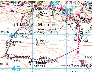
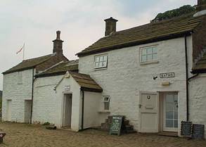 The track got steeper and about half way down the hill we arrived at White Wells, Ilkley’s first Spa Bath. It now serves as a café although it is still possible to see part of the old baths and the natural spring water that fed them.