
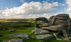
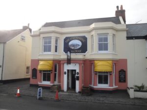
This year we headed back to the other end of the country, having decided to visit Dartmoor. The chief beneficiary of this choice was Phil, who lived just over 50 miles away from where we decided to stay – Paignton, a seaside town in Devon, on the coast of Tor Bay and part of the area known as the English Riviera.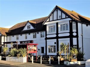
Graham B, Peter and Laurie were the first to arrive at the Strawberry Fair Hotel on the Thursday evening, and after unpacking they went next door to The Ship Inn.
Geoff arrived at about 6pm and was offered the use of a family room as a single, meaning he had a lot of room to spread out. Apparently this was a reward from the owners for having made the booking.
After joining the others in the pub for a drink and something to eat, they walked into town to book restaurants for Friday and Saturday evening. It was then back to the pub to wait for Malcolm, Drew and Brian who arrived at about 11pm.
Friday
At breakfast the following morning there was the opportunity to compare notes and do a bit more catching up. This revealed a mixture of reassuring certainties; Graham still did not like tomatoes or baked beans, there had been a technological advance with Peter now owning waterproof socks, and a complete surprise with Brian having recently given up smoking.
As a departure from the norm the hikes originally planned for the Friday and Saturday were swapped. This not only meant that everyone would be able to enjoy the wild Dartmoor route but also there would be a change to the lunch time arrangement, with the packed lunch not being needed until Saturday.
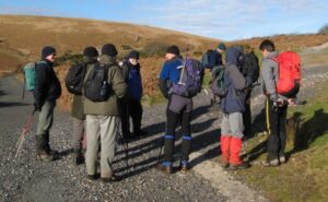
We set off at about 9.15am and were delayed on route due to heavy traffic in Totnes. We eventually arrived at a car park in what felt like the middle of nowhere and set off at about 10.30am. It was a glorious day – cold, sunny and crisp.
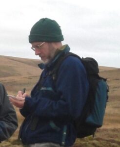 Malcolm agreed to write up the events of the weekend and every now and then could be seen making a few notes. His efforts form the basis of this report that has been added to through the addition of remarks and comments of some of the other hikers.
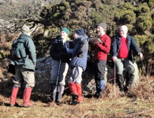
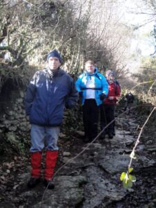
We set off down the track to Blackslade Ford and then steadily up hill. When the track ended we continued across country in the direction of Tunhill Rocks.
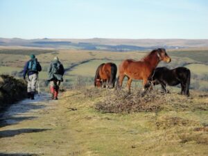
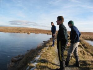
It was not long before we encountered the famous Dartmoor Ponies and with a lovely clear sky we had some great views, including one of Widecombe from the crest of the hill.
 The route down to Venton looked fairly straightforward as we headed across county towards a track. However, we had not gone far before we realised that there was no access to the track that we were aiming for. The problem was laughed off and after consulting the map we had to head east, back up the hill, and then follow the edge of the fields down to the road at Venton.
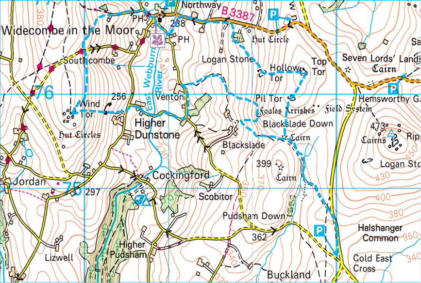
 Upon reaching Venton we followed the road south and then turned west continuing on the road to Higher Dunstone. It was then time to do a bit more cross country walking as we climbed the hill to Wind Tor. It was well worth the effort as we were afforded some more great views. We continued north at roughly the same height following the edge of the open land until we reached a narrow path that led us down the hill into Widecombe.
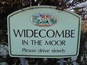
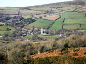
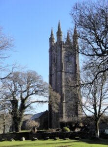
Having arrived at the north end of the village we followed the road south, past the church.
 Eventually, after a morning of several ups and downs, some detours and some black ice we arrived for lunch at the Rugglestone Inn, which was very picturesque. The pub was warm and welcoming.
Whilst most of us indulged in the good lunch Malcolm spent some time looking at Brian’s holiday snaps of the sailfish he’d caught in Kenya and then he went to sleep in the corner.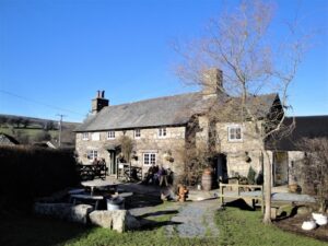
After lunch we left the pub with its free-range chickens, cats and Dartmoor pony and walked uphill out of the village to the B3387. We followed the road up the hill to the open land and cut south east around the enclosed area to Hollow Tor.
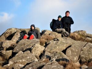
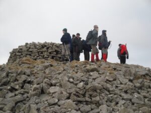
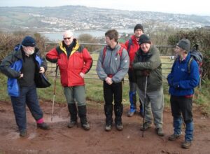
 It was here that we started a bit of a photo shoot, as a variety of pictures were taken as we climbed up, not only this Tor but also Top Tor and Pil Tor along our route.
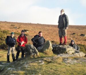
As we admired the views from the rocky outcrops at the top of Blackslade Down Malcolm continued to make his notes. He even asked other members of the party for their thoughts and was rewarded with a couple of quotes: “Thirty Nicorettes for £20” and “It’s all downhill from now on”.
Indeed it was all downhill from then as we made our way down the hillside and back to the car park via Blackslade Ford. We had covered about 7 miles and with the help of Graham’s bird spotting had managed to see a raven, a buzzard and a nuthatch.
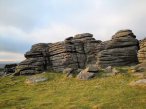
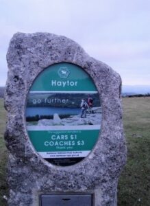
Before returning to the hotel we decided to drive a couple of miles in the opposite direction to stop and have a look at Haytor, believed to be the tallest Tor on the moor. Had there been more daylight some of us may have had a go at climbing it.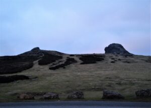
 Back at the B&B we waited for Martin and Simon before we went to the pub, where we were finally joined by Graham H and Phil. It was then off to the Honeymoon Chinese restaurant, where most of us enjoyed the help-yourself buffet that was on offer.
After the meal Malcolm decided to call it a day, but the rest of us went to the pub opposite, before returning to our regular haunt for one final pint.
Saturday
At breakfast the conversation centred on snoring and the Egg Question. Should they be fried or poached? And, if fried, should they be turned? And, if turned, in which direction?
 After this riveting discussion and ensuring that we all had a packed lunch it was about 9.15am and time to set off. There were no traffic problems and we arrived at Shipley Bridge car park about 45 minutes later.
The car park is on the site of an old China Clay works from the late 1800s, that had previously been a works for the product Naphtha (a flammable liquid hydrocarbon peat mixture), made from the peat on Dartmoor.
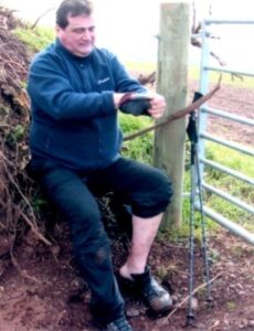
We were putting on our boots when Malcolm suddenly realised that he had left his back at the hotel. Fortunately he was able to borrow a spare pair and glad that Martin had remembered the Scout Motto better than he had.
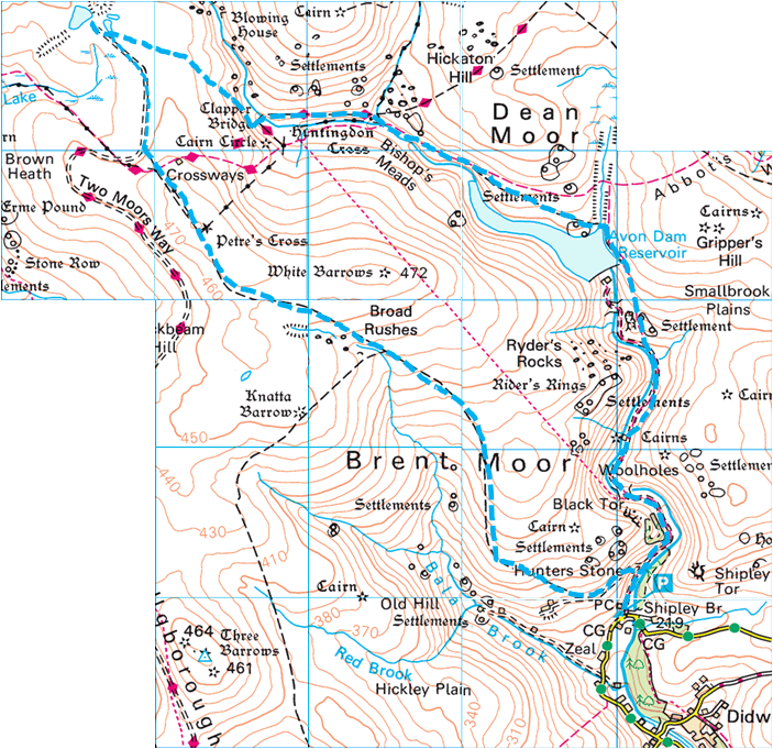
 It was another cold clear day with plenty of ice about and thick frost / light snow on the hill tops. We followed the tarmac path north, occasionally stopping for a breather, before reaching the Avon Dam Reservoir about an hour later.
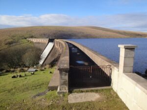
We followed the edge of the reservoir north and crossed Brockhill Stream before turning west along the Abbot’s Way to the Huntingdon Cross, which was partly hidden by a dry stone wall.
There we had a little difficulty crossing the stream, before walking along the Two Moors Way to the Clapper Bridge, where photographs of us all crossing the stone bridge were taken. We planned to have lunch there but as it was only about 12 noon, we decided to press on.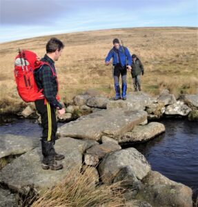
From there we headed north west over a tussocky hillside that would have been boggy if it hadn’t been mostly frozen. Although there was no obvious path we knew where we were heading – Redlake on top of the hill close to the spoil heap that was clearly visible. We all chose our own way over the difficult ground and managed to converge at the top.
Redlake is an abandoned pit that had been flooded, creating a lake (the word “lake” derives from the streams flowing through the areas, not the artificial lake itself, which is a recent feature). This is the site of an old China Clay works that was active in the early 20th century, closing down in 1932 during the depression. All that remains now is a demolished pumphouse, along with the ruins of other pit buildings.
The lakes were frozen over in places and an impromptu curling match followed – just the stone throwing (no brooms). The stones skittering across ice made a very eerie sound. The lakes are high up and upon climbing the spoil hill we could see a long way in every deserted direction – glorious isolation.
 We decided to take lunch here and settled down amongst the ruins.
Having eaten our individual supplies we enjoyed a piece of fruit cake, courtesy of Mike Hicks, Graham’s dad, who had recently celebrated a birthday. This was followed by a choice of hip flasks.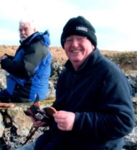
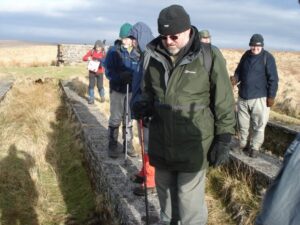
We set off again along the track of the old Redlake Tramway, heading south east then south until we reached the junction that linked up with the Two Moors Way. The Tramway was originally built to carry supplies and workers between Bittaford and the clay workings at Redlake. Today the track bed provides an eight mile picturesque walk that provides access to several tors and hills.
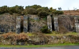
At the junction we crossed over onto the track of the old Zeal Tor Tramway that weaved its way south east across the moor. This tramway had previously been used to send peat down to the Naphtha works at Shipley. The first significant place on the Tramway was the old Greenhill Mica Works, where we investigated the remains of the filter beds or ‘concentrators’ that removed sand and mica from the clay before being sent further down. As the hike continued we passed Western White Barrow and Petre’s Cross, and saw evidence of the very old tin workings, before moving on to Eastern White Barrow.
Graham B’s knee was giving him some trouble as we steadily made our way down the hill to meet up with the path used on our outward journey. It was then just a short walk back to the cars. We had probably covered about 7 miles in all, and in addition to seeing another raven and buzzard, we had seen some mallards.
As we had finished fairly early we stopped at Dartington on the way back for a selection of cream teas and a controversial suggestion from Peter that Winter Hikes should include a bit more to look at, by taking in more villages and places of interest and less desolate moor and mountain. The idea met with a mixed response but the seed had been sown for a future discussion.
Back at the hotel we showered and snoozed before meeting up in the Ship Inn next door where an improvised game of shove ha’penny resulted in a tie between the two Grahams. It was then on to Cilento Evolved Indian Restaurant, where we discovered that despite having booked they were still taken by surprise when we ordered some food.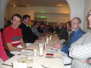
While we waited for the food Brian had a cocktail with a Chilli in it, others had beer, lassi or water. As we grew restless they offered to sell us some poppadums, which we didn’t want, they offered to sell us some more drinks, which (most of us) didn’t want, and we sang Happy Birthday for someone in another party.
Eventually, after an hour and a half our food arrived which, despite the awful service, was very good. Peter left the restaurant early and when the rest of us left for a final drink in our ‘local’, Malcolm went back to the B&B for an early night.
Sunday
At breakfast we were amused, but not surprised to learn that Phil’s snoring could be heard from the floor above. There was more Feng Shui with eggs, before we packed, loaded the cars and paid our bills.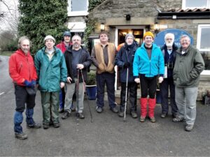
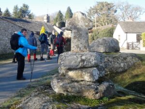
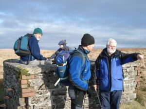
The hotel proprietor (Kevin) happily agreed to take a group photo but then realised that he had to stand in the middle of the road to do it. And that we had to repeat the task with several different cameras. We gave him our thanks and finally set off at about 9.30am. We drove out of Paignton, through Torquay to a car park above Labrador Bay, near the Teign estuary.
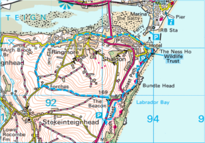
The weather was a little overcast but there was still no sign of rain. We had been lucky. We headed north up the main road and then onto the minor road at the fork. Our first brief stop was at the trig point. Our route took us inland where we discovered the track was, in places, completely covered in water and ice.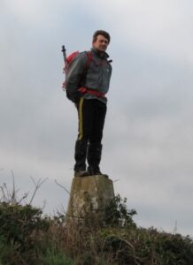
Most of us got round this by climbing the bank that ran along the edge of the path and walking along the top. However, for some reason, Laurie decided to stay on the track and found the water deeper than expected.
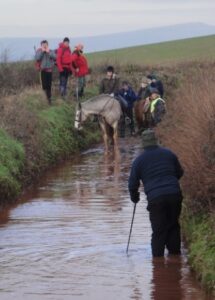
After we had waited for him to take his boots off and wring out his socks, we set off again. At the end of the track we turned left and then right onto the track heading north towards the estuary.
At the road junction we turned right and headed towards Shaldon. On the outskirts of the town we joined The Templar Way (and South West Coast path) to take us north of the town. However, after a little way we had to leave it because of reconstruction work. As a result we had to continue through town and join it again later.
We stopped occasionally for photos as we followed the path along the coast, first east and then south. There were several steep ups and downs before a final up above Ness Cove. When the path met the main road some of us said our goodbyes, with some wanting to continue on the path back to the car park, and others wanting to take what looked like a quicker route along the road. As it happened we all met up again back at the car park.
About 3 miles had been covered that morning during which we had seen quite a bit of wildlife that included a fox, a kestrel, a mute swan, a black swan and turnstones.
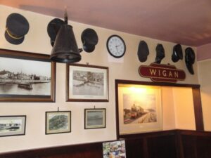
We said our goodbyes again and set off for home, although some of us paused for a drink and roast lunch in the Atmospheric Railway Inn at Starcross, just up the coast.
As we departed Geoff was designated ‘Keeper of the Leftover Kitty’ and entrusted with £23.10 to carry forward to next year.