
 This year’s venue was set during last year’s hike and took us to an Area of Outstanding Natural Beauty not visited before and to a location more convenient for the northerly constituents. Graham B. organised the itinerary, as usual, Geoff the accommodation, as usual, and with everyone being most grateful, as usual.
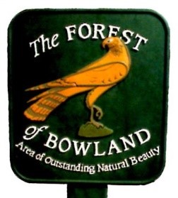
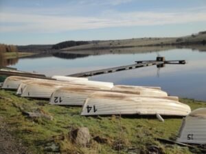
Only 300 square miles in extent the Forest of Bowland is a hiker’s delight with half in Lancashire and half in Yorkshire. To the west is the agricultural plain of the Fylde, with the River Lune to the north, and the Pennines to the east.
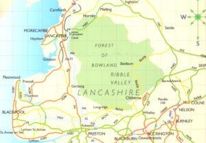
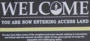
With the area in general only being opened to the public by the Right to Roam Legislation in 2000, it is still a fairly ‘secret’ place, with few inhabitants – even the towns and villages around its edges are modest in size. Its privacy is easy to maintain because there are no major roads or rail links and exploration is best done on foot.
We all made our various ways at various times in various weather conditions on Thursday to the Broadwater Guest House on the seafront at Morecombe, with the exception of Graham B who had stayed the night before as he had wanted to do some bird watching during Thursday.
Geoff arrived at about 4pm followed by Peter and Phil. Next to arrive were Malcolm, Drew and Brian, but due to a double booking Brian had to spend Thursday night in the salubrious surroundings of another guest house a few doors down the road.
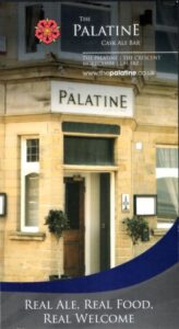
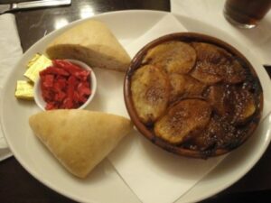
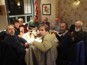
Geoff had researched local pubs so it was then off to the Palatine for something to eat, where we were given a separate room upstairs. Simon, Martin and Curly joined us later. The reviews Geoff had read were not wrong – it was a very good pub with draft beers and a good value meal – all part of the essential training needed that evening for the weekend’s most arduous physical activity the following day, the ascent of Ward’s Stone at 560m.
We didn’t stay there late.
Friday
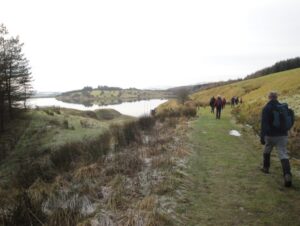
We assembled at 8am for a full English breakfast before taking a trip to the local supermarket to buy packed lunches for the day. It was then a half hour drive to the Jubilee Tower car park where we disembarked and kitted up. It was cold and windy, some parts more than others.

We set off at about 10am on an immediate climb towards the cairn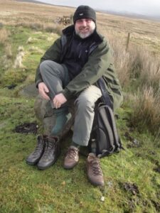 known as Shooters Pile and the summit above.
Putting into practice the hundreds of years experience between us we immediately spilt into two separate parties and struggled up over the moorland either side of a fence.
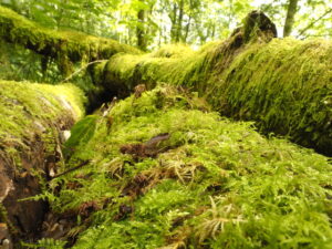
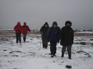
The first 0.5km set the scene for what was to come, being very wet and very very muddy, and having to plot the best route between the bracken and tussocks and stream crossings.
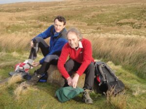
One particular stream crossing entailed a movement akin to shuffling feet along a low lying horizontal caber whilst leaning over and hanging onto the wire fence. Having the benefit of watching those before him Peter’s technique was deemed by the majority the most proficient.
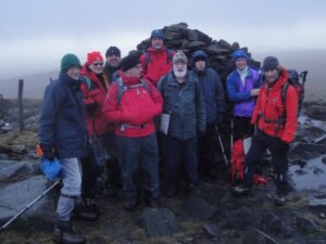
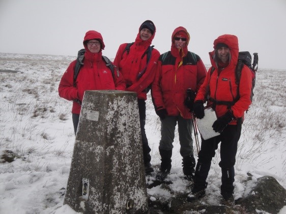
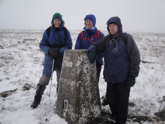
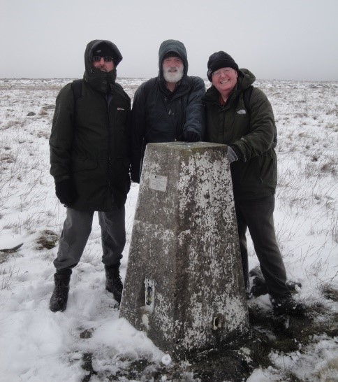
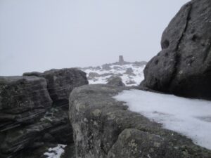
There was a quick photo stop at the cairn before the last 5 minute climb to the style over the fence where we reached the snow line, with mixed visibility but good views when the clouds broke. The ascent had taken us about an hour.
We followed the footbath over Grit Fell, heading generally east to the western summit of Ward’s Stone. A fell runner suddenly appeared from nowhere and was surprised, and initially seemed to be somewhat annoyed to find other souls on his route on the fell.
Dressed only in shorts, hat, gloves and a cagoule he contrasted with the layers of man-made fibre of the ten individuals before him. We advised him that joggers generally have more success if they stick close to the car park but they’re made of sterner stuff those northern folk.
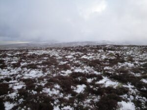
Ahead it became evident that the light dusting of snow on the higher fells, from Thursday night was a precursor of what was about to come – a dark cloud caught us up and started to dump snow upon us, with increasing intensity. Those that made quicker progress sought sanctuary behind Ward’s Stone, safe in the knowledge that the trail following abilities of those ex Scouts behind would follow the footsteps in the snow, albeit the steps were fast disappearing in the snowstorm.
 When we met up again it was decided to stop there for lunch – in the sheltered position just below the trig point. Nobody went hungry despite the debate as to whether Mrs Hime’s sandwiches were made for both Martin and Simon or just the one of them.
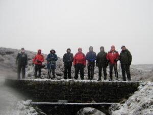
After lunch we crossed the plateau to a second trig point on the eastern summit, about a kilometre way and a meter higher. A series of group photos, based on the colour of our coats, were then taken. Fortunately the snow stopped and it became a bit brighter.
 It was then time for the descent and we headed cross country in a south westerly direction to the track below us. We turned right and followed the track and after stopping for another photo before arriving at Grizalda Head.
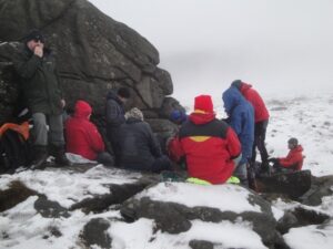
There we noticed a Luncheon Hut (not named on the map), a grouse shooters haven, so made our way there for shelter and a short rest. The modern bothy open on one side and with a heather floor, and heather decorated columns and beams, had benches and tables. It was perfect for us to sit a while and enjoy a cup of coffee.
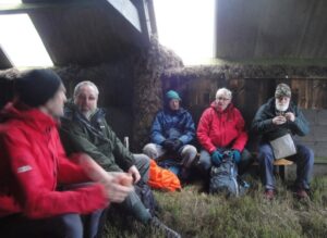 Brian was about to light up a cigarette when Phil insisted on upholding the rule of law on smoking rights by making him vacate the hut. Despite this the smoke just drifted back and collected in the hut.
After the stop went back down to the track junction and followed it down to just north of the stream crossing. We turned west and headed across the fellside towards the Jubilee Tower. There were two small bridges to locate in order to cross the streams, however, the bracken was the tallest, the puddles the wettest, the mud the muddiest and the snow which has eased up for a while came on again, with gay abandon, which made for very heavy going. Although Peter and Phil found the going particularly hard going we all managed to navigate fairly we ll and hit the tower at around 4pm.
Throughout the day Graham B was seen stalking with binoculars like a grey, fumbling Rommel. The rest of the party strained equally to spot any trees in Bowland’s forest. The final tally was 15 grouse, 32 disembowelled crows and 2 trees, one of which was judged to be dead.
We drove back to the B&B where we were pleasantly surprised when Alex and Jean Blore, the proprietors, took all our wet clothes and boots for drying.
After showering and a short rest we made our way to the Palatine for a well-deserved drink and to reflect on a good days hiking in interesting conditions.
Friday is Chinese night so it was then off to Honey Tree Chinese restaurant for something to eat, where we were surprised to find draft Tetley available. The food was good, as was the atmosphere, with there still some evidence of the celebrations that had taken place on the 22nd when the Chinese New Year (The Year of the Dragon) started.
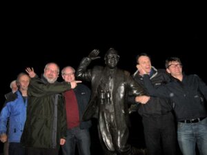
After the meal some returned to the B&B while others promenaded along the sea front to the Eric Morecombe memorial statue.
Saturday
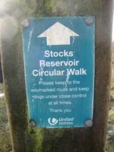
Our plan to hike around Stocks Reservoir received the approval of Alex Blore, the B&B proprietor, as he had been fishing there a number of times. However, he recommended an early start because of the time it would take to drive to our starting point. We also had to ensure that we were not late as we had arranged to meet Graham H at 9.30am and, we had been told that we should ensure that we did not arrive later than 1.30pm at the pub for lunch, as the kitchen shut at 2pm. Breakfast was therefore arranged for 7.30am.
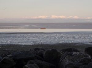 Things did not go as planned. Brian, who had decided not to move in with the rest of us, preferring the other B&B was up late, and Peter had dashed off to get some photos of the Eric Morecombe statue. While the rest of us waited we enjoyed the superb views from outside the B&B over the bay to the Lake District where the mountains were covered in snow.
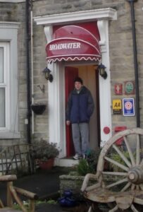
The half hour delay turned out to be a bit of a blessing in disguise as the road conditions, whilst still treacherous, would have been a lot worse earlier on. We drove past the Jubilee Tower and then through the Trough of Bowland where the very cold weather had resulted in the small B roads being, in places, thick with ice that had barely thawed. Blue skies, snow and ice made for a lovely careful drive!
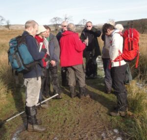
 We arrived at the car park (at spot height 184 on the map) beside Stocks Reservoir at 10am but Graham H was not there. With no mobile phone reception a search party set off to check the other nearby car parks, Due to our lateness Graham had thought he had the wrong car park and was also touring the vicinity. We eventually all met up and finally set off along the footpath through the wood in a north westerly direction.
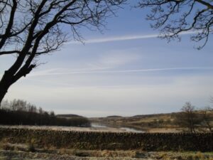
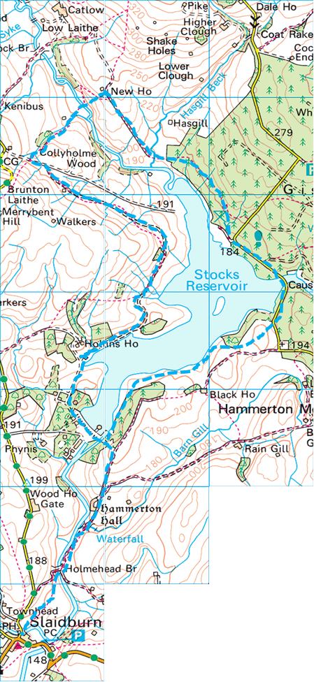
After we emerged from the wood we continued on the footpath in roughly the same direction to New House where, instead of following the footpath round to the river, we rashly went down the steep slope, slipping and sliding down to the river. After stopping for a few minutes to take photos on the bridge we went up the valley opposite.
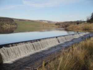
We continued along the route of the official Stocks Reservoir walk which at this point follows an old railway track used in 1932 when building the dam.
The route was either frozen or wet and muddy but it was a dry, still and bright day which helped and there were beautiful views to the snow covered fells all around.
Despite having to maintain a good pace to ensure we did not miss our lunchtime reservation there was still time for the occasional breather and a cup of coffee.
As we approached the reservoir the path veered south and followed the water’s edge round to the dam, where there were more photo opportunities.
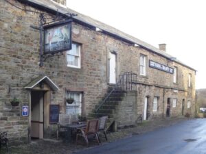
We crossed the dam and then left the circular route by cutting up the slope via a permissive path to over a style. We had trouble finding the marked path and as a result we all ended up on the wrong side of a wall. We headed south to the Holmehead Bridge, where we crossed the river and continued on the footpath to Slaidburn for lunch in the Hark to Bounty, an old inn, reputed to date back to the 13th century.
 The local ale and home cooking was excellent and we were glad that we had arrived before our deadline.
The dessert toppings included custard, ice cream or cream and there was no holding back by some when we were unexpectedly offered combinations of any or all.
 We all joined in the pub quiz from Malcolm’s paper. He then turned down the offer of help with the crossword but gallantly gave up the motoring section for Alan’s boots.
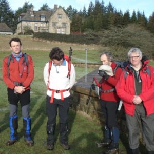
We left sometime around 2.30pm and retraced our steps back to the reservoir, although there was a slight delay for Malcolm who remembered just before the point of no return, that he had left his walking stick at the inn.
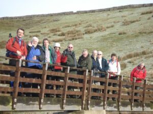
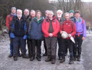
 After rejoining the circular route we followed a permissive path that roughly followed the edge of the reservoir round to the road. There, a passer-by was kind enough to take a group photo of us, but he could not understand why we were not walking in the Lake District.
The final stretch of the route took us through the woods – The Forest of Bowland! – and along a path close to the road leading back to the cars. This was a particularly muddy stretch requiring one or two diversions from the path and with one or two unfortunate slips some of us arrived back wetter and muddier than others. It was about 4.30pm and starting to get dark.
Farewells were said to Peter who had to get back for a birthday party in Chester.
The rest of us drove back via Settle and north of the Forest of Bowland to avoid the earlier ice rink route, in and around the Trough of Bowland, As a result we did not get back to the B&B until about 6.30pm.
After a shower and a quick drink at the Palatine we went for our usual Saturday night meal – a curry – at the Curry Leaf Indian restaurant. The mixed reviews were about right with there being a long wait for some tasty dishes and some that were cold and disappointing.
It was then back to the B&B and bed at a reasonable time.
Sunday
During Sunday’s leisurely breakfast a renegotiation resulted in a change from the planned morning’s ascent of Pendle Hill, which was considered by all a bit too far to drive to (and probably a bit too steep), to a jaunt up to the Darwen (Queen Victoria’s Diamond Jubilee) Tower in the West Pennine Moors, just south of Blackburn and the M65. It was also nearer to the M6, helping those with a long drive home.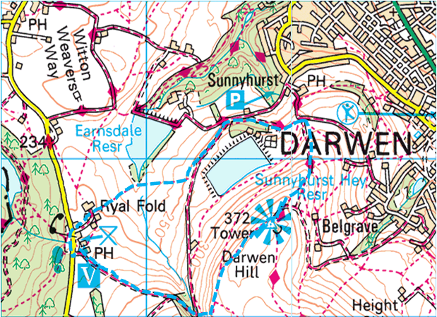
Graham B had extra maps and the decision was made even easier when Graham H recommended a pub – The Royal Arms – at Tockholes, previously frequented by him, that was adjacent to a car park where we could park. We drive the 40 miles in convoy, parked and prepared ourselves for the short morning hike.
It was a bright morning and slightly less cold than Saturday and, there was no ice.
We set off by following the path south east to the stream crossing and then up a steep hill to the path that led north to the tower. We were a little disappointed to find, that after our brisk walk to the tower, it was locked. The area was very busy with mountain bikers, walkers, and families out for the morning, some possibly encouraged by the snow that was still on the ground.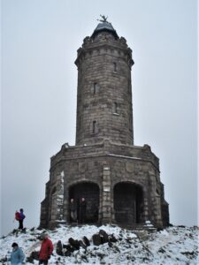
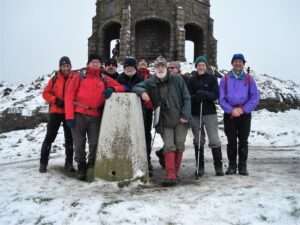 After the usual photo session we headed north east along the path and then a track that went steeply downhill. At the next junction we took the path north of Sunnyburst Hey Reservoir and then south of Earndale Reservoir, back to the pub.
The pub had an open fire and we enjoyed a delicious Sunday lunch before it was time to say our farewells in the car park.
It had been a memorable weekend.