
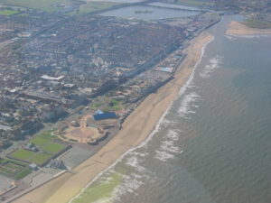
The 2014 hike plans were dusted off and put into action for 2015. We kept our promise with the Berwyn Guest House in Rhyl, with Geoff, Graham, Laurie and Phil arriving early, albeit exactly one year after they were originally expecting us.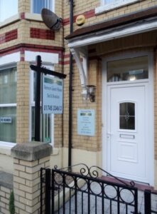
We went off to find somewhere to eat, stopping at The Royal Oak close to the B&B. However, the pub did not do food, so the walking continued until we ended up at The Harbour, a Hungry Horse pub at Foryd Bridge, about 1k west of town.
 Drew, Martin and Simon arrived later. A rare absentee though was Malcolm Rush who was taking part in the Southern 50, a hiking competition that has been organised and run by the Greater London North Scouts since 1979 and attracts teams from all over the country. There is a 50 mile and 50 kilometre route, as well as a 30 kilometre one for Explorer Scouts. Malcolm did the 50k route and was part of a 5 man team that include Debi Rush (Drew’s wife) and raised £1,000 through sponsorship, which went towards the cost of their Group attending the Haarlem Jamborette in Holland: an international Scout camp held every four years.
We enjoyed the good food at The Harbour although the beer was poor. However, when we ordered our second round the barman brought it to our table and then went home without ringing it up on the till. As a result the other staff said they were unable to take our money!
After our free round we made our way back stopping again at The Royal Oak where we knew we would get a decent pint.
Friday
Breakfast came and went with most of us enjoying the ‘full English’. We got away at about 9.30am after a brief visit to the local convenience store, to either get a packed lunch or top up on the one we brought with us. We drove to the Penycloddiau car park situated on the Offa’s Dyke footpath above Llangwyfan.
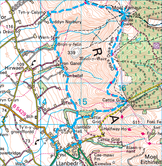
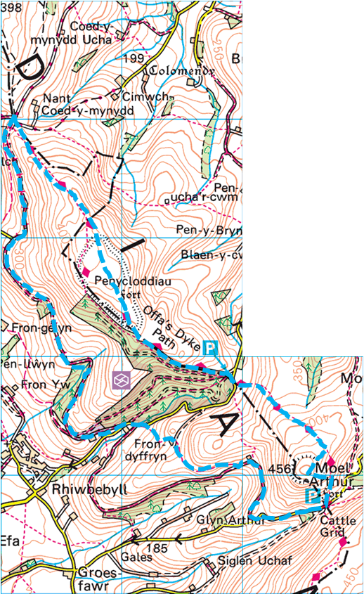 Our plan was, as usual to do a circular walk, but also to include two other key elements. Firstly part of the Clwydian Range, an Area of Outstanding Natural Beauty, and where some of Britain’s most dramatically situated hillforts are located, and secondly to cover a section of the Offa’s Dyke footpath. The path as a whole covers 177 miles, roughly following the Welsh / English border and Offa’s Dyke, the great frontier earthwork built by Offa, King of Mercia between 757 and 796 A.D.
The footpath opened in 1971 and is one of Britain’s National Trails, drawing walkers from throughout the world. It is worth noting that Martin, along with other members (including Curly) of the newly formed 22nd Finchley Venture Scout Unit, walked the full length back in August 1978. It took them two weeks and they camped out along the route.
Having started at the southern end by walking over the Severn Bridge they finished their hike by walking barefoot into the sea at Prestatyn.
It was misty and there was light rain in the air as we set off along the steep path to the south east, before veering off south west to the top of Moel Arthur. Moel Arthur is a small circular hillfort crowning a very prominent hill. Although it covers only two hectacres, it boasts some of the largest banks and ditches of all the hillforts.
It overlooks the Vale of Clwyd, to the north was Penycloddiau, our objective for the afternoon, and to the south, in the far distance, we could see the jubilee tower on Moel Famau, our objective for Saturday. In the valley we could also see the farmhouse owned by Geoff’s sister, and was used by Martin on the 1978 hike.
After admiring the scenery we went down to re-join the Offa’s Dyke Path and followed it south to the nearby car park. From there we followed the road west and then north until we met a track on our right. We followed this track north and then west, to where a footpath on the right would have led us back to the cars.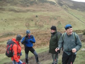
However, we continued on the track over the top, through Fron-dyffryn and down to the road that runs alongside the wood. We turned left and followed the road a short way before turning north onto the Clwydian Way. This was a rising zigzag track that took us past a big old water tank.
During the day Martin had been helping Simon to carry his gear, as Simon was nursing an injured shoulder following a fall from his bicycle the previous week.
As a result of this good deed, when we stopped for lunch near the end of the track, Martin had, for the very first time, control over “Mrs Hime’s sandwiches”.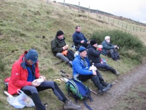
Fully refreshed, and a little damp as a result of the rain that had just started, we continued north to a big intersection where we turned south onto the Offa’s Dyke path again for the return journey.
 Our next target was the fort at Penycloddiau, the largest hillfort on the Clwydian Range and one of the largest in Wales. It has some impressive ramparts and encloses an area of 21 hectacres.
As we followed the direct route back to the car park we noticed a police helicopter overhead, and as we descended towards the car park there were police in about 4 cars, who we were advised, were probably looking for one of the patients at Highfield Park (a residential mental health care institution just down the valley).
 We drove back to the B&B and after getting cleaned up and changed some of us went for a walk along the front, stopping for a cup of tea. We found the Indian restaurant and booked a table for Saturday evening and then found The Sussex, a Wetherspoon pub. Peter Cox joined us at about 6.45pm to spend one evening with us. He had travelled over from Cheshire and on the way had stopped at Rhyl cemetery to pursue a new hobby of photographing headstones to add to the Find A Grave web site.
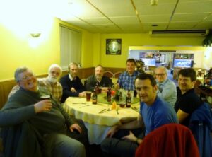
After a drink we went to Yueng Sing Chinese restaurant that was empty except for us. They had bottled ‘Rev James’ available that we all enjoyed but when we discovered they did not have enough for a second round Peter suggested they should pop down to Aldi and get some. Although they did not adopt his idea the very good waitress coped well with Peter and kept us amused as she handled his ‘chat-up’ lines and his efforts to try out some of the Chinese he knows.
After the meal we thought that we would look for somewhere to drink and the Navy Social Club was roughly opposite. We had a look inside but soon realised that we were not going to be welcome visitors, so decided to go back to the B&B.
Saturday
Breakfast was a jolly affair as the main topic of conversation centred on funerals. Drew was trying to convince everyone on the merits of having a funeral payment plan. We were not sure if he was trying to sell them or make us just think about the benefits.
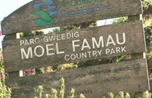
It was about 9.30am when we left the B&B. Our plan was to hike a bit more of the Offa’s Dyke footpath in the Clwydian Range, specifically taking in the Jubilee Tower, in the heart of Moel Famau Country Park.
We drove to Llanbedr and then took the narrow track up to the car park along. It proved to be a bit tricky as we climbed into the mist and especially as, at one point we had to reverse down the hill to a passing spot.
 As we parked up and prepared to start hiking we watched the tea shop in an old mobile shepherds hut being set up for the day.
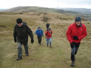
 The car park was on the route of the Offa’s Dyke path so we followed it, initially west and then north up the hill. As we progressed through the mist towards the top of Moel Famau we were passed by a group of runners coming down the hill on their morning run.
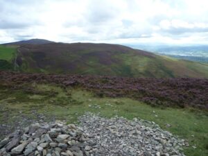
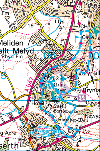
At 554m (1818ft) Moel Famau – which means ‘Mother Mountain’ in welsh – is the highest summit in the Clwydian Range and the highest point we reached during the weekend.
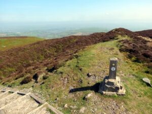
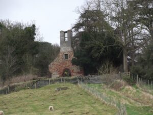
At the top is the Jubilee Tower, an iconic local landmark, said to be visible for many miles around and seen by us from Moel Arthur the previous day. Although not clearly visible because of the mist, we did spend some time climbing over the tower ruins.
The picture opposite is what we would have seen had it been a clear day.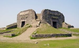
It was built to commemorate the golden jubilee of George III in 1810, and was designed by Thomas Harrison of Chester, like an Egyptian obelisk with three tiers. Although the foundation stone was laid in 1810 by George Kenyon, 2nd Baron Kenyon, the tower was never completed due to a lack of funds. In 1862, a major storm brought down the tower. The remaining upper part of the structure was demolished for safety reasons leaving just the base.
We continued a little further along the Offa’s Dyke path then out to the west into the valley before turning south, sticking as close to the footpaths as possible along the edge of the open land. This section was not without incident as Graham managed to slip while crossing a ford and had a little dip in the water.
At Fran Goch we realised that we were a little behind schedule and thought we may end up being late for our lunchtime booking. Graham, Laurie, Drew and Phil therefore opted to take a quicker route by dropping down to the road and following it into Llanbedr.
Geoff, Simon and Martin stuck to the planned route by continuing to follow the footpaths south. At the end of the path was Llanbedr Hall, originally a home for the landed gentry, Then during the 1970’s and 80’s it was used by the Findhorn Community – an eco-community still going strong in north Scotland, but it is now the local community centre.
 From there they could see the ruins of St Peter, the old parish church that was abandoned in 1863 in favour of a newly built church. The ruins are now classified as a Grade II Listed building.
They tried to cut through to the church but there was no way, so they followed the path round the north side and joined the road on the edge of Llanbedr.
It was then a short walk to the Griffin, where Graham and the others were waiting, having arrived about 15 minutes earlier. The time was now 1.30pm.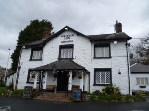
The pub was welcoming and the food good. Knowing that it was a reasonably short hike back to the cars we stayed in the pub for quite some time enjoying the rest and the warmth. It was just after 3pm by the time we left for the last leg of our journey.
We headed through the village, past the church and up to Llanbedr Hall. From there we headed east for 1.5K up an increasingly steep slope, the last part of which was a real challenge. Unfortunately we arrived back just as the tea shop had closed.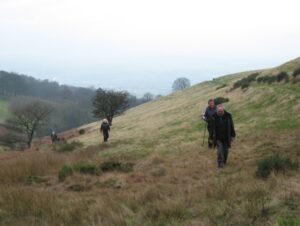
In the evening we went to the Wetherspoons for a drink and then onto the Chilli Pink Indian restaurant, which was decorated with pink and silver balloons because it was St Valentine’s Day. In addition to the standard menu they offered a buffet style service, which several of us had. The food was good and reasonably priced.
Afterwards we went back to The Sussex for another drink but did not stay long as we were too tired.
Sunday
We left the B&B at about 9.30am after paying the bills and drove to Dyserth. There we found parking along the A5151 on the site of an old siding at the end of the old Prestatyn – Dyserth railway line.
It was a bright day as we set off along the main road for a short way before turning left onto the footpath. This went west and then north before reaching a road where we turned left to the crossroad junction. From there it was a straight climb to the top of Craig Fawr.
 Graig Fawr, the highest point of the day’s hike, and offering superb views, consists of wooded slopes and limestone outcrops that rise steeply above the village of Meliden. The rock is a dominant and dramatic landscape feature at the northern end of the Clwydian Hills.
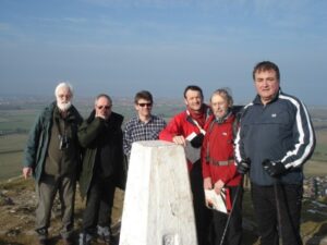
After the usual photo session around the trig point, that despite his injured arm, Simon was still able to climb, we partly retraced our route back down the hill, but veered left onto the footpath leading down to the road.
From there we headed east until we met the Offa’s Dyke footpath, and for the third day in a row we walked another stretch of it. This time we headed north, although it went round above Tan-yr-alt, where a house had been built in an old quarry. A little further on we took the path leading down to the wood and the cave marked on the map.
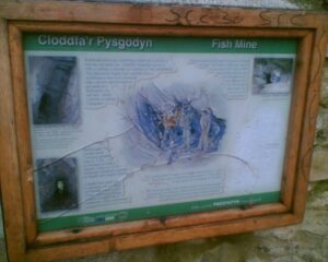 ‘The Cave’ was in fact an old lead mine and had been given the name ‘Fish Mine’ after the fish shaped spoil heap that once lay on the slopes below it.
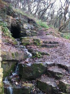
The limestone hills held rich seams of lead and zinc and the ‘Fish Mine’ was one of many shafts and tunnels that remain from the old mines. The London Lead Company first began mining here in 1724 and a few tons of lead was extracted in 1755 when it was leased by the Bishop of St Asaph, but it was never very profitable.
Some of us decided to explore and went part of the way in, but as we did not have a big enough torch and as the sign said that parts were flooded we decided not to venture any further.
We continued along the footpath until we reached the entrance to the golf club, where Martin noticed that they appeared to offer a very reasonably priced Sunday roast. Alas though, we were too early.
From there we followed the old railway track passing a number of old adits cut into the slopes below Graig Fawr.
It was a pleasant walk but nothing else of great interest, although as we neared the end, where the cars were parked, and after walking under a bridge we passed an old loading crane.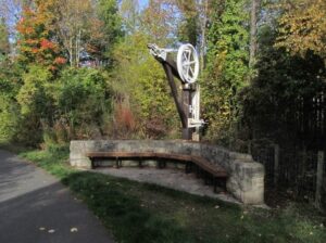
It was the end of another enjoyable weekend and we departed on our journeys home.
Graham and Geoff though, made one last stop in Trelawynd, where they had a very good Sunday lunch before going their separate ways.