
For the Golden Anniversary Hike we returned to the area in Surrey that had seen our first two hikes.
On the Friday we planned to climb Box Hill as we did in 1969 and on the Sunday ascend Leith Hill, just as we had done on our very first hike in 1968, save by a much easier route. The plan for Saturday was to take a gentle circular walk over the South Downs from Brighton and Hove to the Devil’s Dyke Inn for lunch and back via the Dyke itself.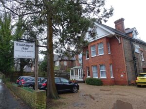
This year’s ‘Golden’ hikers were essentially the hard core of regulars of recent years. All except Graham H and Simon initially gathered on the Thursday night at our accommodation for the weekend – the Wimblehurst Hotel in Horsham, West Sussex, arranged for us by Laurie in consultation with AWH planners Graham B and Geoff.
 Deciding to forgo the delights of the nearby cowboy-themed pub the ‘Smith and Western’, we headed a few hundred yards down the road to the ‘Dog and Bacon’ in search of our dinner, only to be told, as we supped our first pints, that the chef could not manage nine meals at such short notice – “sorry guys, you should have booked”.
Disappointed but undeterred, we set off on the mile walk into Horsham town centre where we were well looked after in the ‘Black Jug’, a busy pub where both furniture and customers were re-arranged to make room for us and for Simon, who arrived a little later.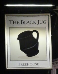
The trek back to the hotel provided a timely opportunity to walk down an excellent dinner and quite a lot of ale, resulting – for some of us at least – in a more comfortable night’s sleep than we might otherwise have expected.
Friday
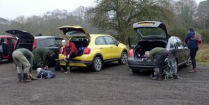
After a good breakfast on the Friday – albeit served by a waiter whose customer service skills would not have been out of place at Fawlty Towers – we set off in a convoy of three cars for Box Hill in Surrey, stopping briefly at the local convenience store to purchase our packed lunch.
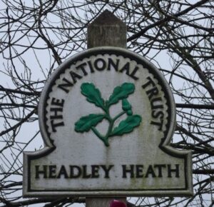 We met Graham H at 9.45am in the car park on Headley Heath, some 3 to 4 miles (as the crow flies) to the north east of Box Hill. While we were fresh from a good night’s sleep, Graham had driven down from Wigan through much of the night, arriving at our rendezvous at 8.30am.
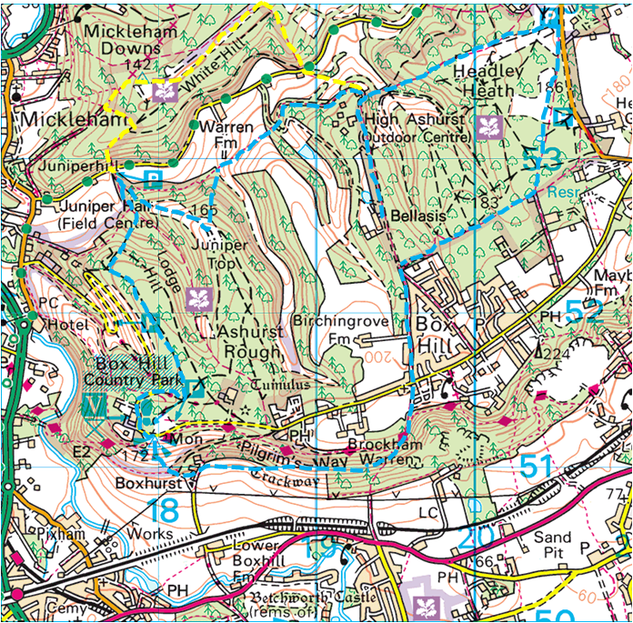
The plan was to cross the Heath and ascend the dizzy heights of Box Hill, following part of the route of the National Trust’s Box Hill Hike.
Headley Heath covers 300 hectares and was given to the National Trust in 1946. It is ‘commonland’ and one of the few places where there is a mix of acid and alkaline geology that leads to a great diversity of plants and insects.
During the Second World War, the Heath was used as a Canadian training ground.
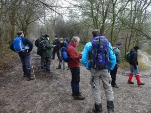
 Duly suited and booted we set off in a southerly direction across the mainly wooded but extremely muddy Headley Heath in the direction of Box Hill, following the Box Hill Hike route.
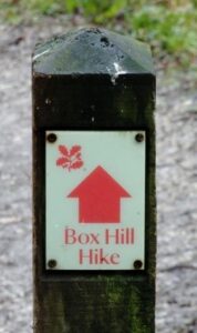
After a lot of map checking we eventually turned south west and then south skirting the village of Box Hill to both the north and west. Upon reaching Boxhill Road which leads into the Country Park and visitor centre, we crossed over and continued to follow the footpaths.
 After entering the wood and dropping down into Brockham Warren we were now well below Box Hill itself. But a series of timber steps on the right provided a stiff climb up. Waiting at the top for everyone to recover, it was all going quite well but was about to go slightly wrong. There was a choice of paths and we all followed Brian who had started along the one marked by the Box Hill Hike markers.
To the consternation of those who had struggled on the climb up, we started to make our way downhill again as we skirted the southern slopes of Box Hill on a path below the Pilgrim’s Way. Inevitably, at Boxhurst, the only way was up – a very steep climb straight up a mercifully wide, albeit slippery, grass track past a trig point to Donkey Green where there is a viewing area.
When Victorian and Edwardian Londoners were encouraged to leave town to take the air and admire the views for their health, Box Hill was seen as a perfect location. And, in the past children enjoyed donkey rides, giving the Green its name.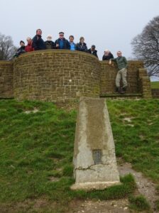
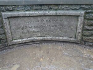 The viewpoint commemorates Leopold Salomons, who gave Box Hill to the National Trust in 1914 to ensure its preservation for the nation – and what a wonderful gift it has proved.
It must be the advancing years, but some of us do not recall the Hill being anywhere near as steep as it was that day!
After the climb, Simon was the only one who was in any fit state to follow the tradition of standing on top of the trig point (for most of us the days of performing this feat are in any event long gone). We were, however, rewarded with a wonderful view across Surrey and Sussex, and after walking around the corner to the visitor centre, we were able to eat our packed lunch in the comparative comfort of the picnic tables outside the Box Hill Café.
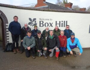 Before setting off again we had a group photo that was kindly taken by another visitor.
As we started to make our way off the Hill after lunch a very helpful National Trust volunteer pointed out a marsh tit, with its distinctive black crown, feeding near the volunteers’ hut.
At the same time a number of us went dashing off in the opposite direction in search of Peter Labilliere’s grave, a local eccentric who had been interred close by, in a upside down position.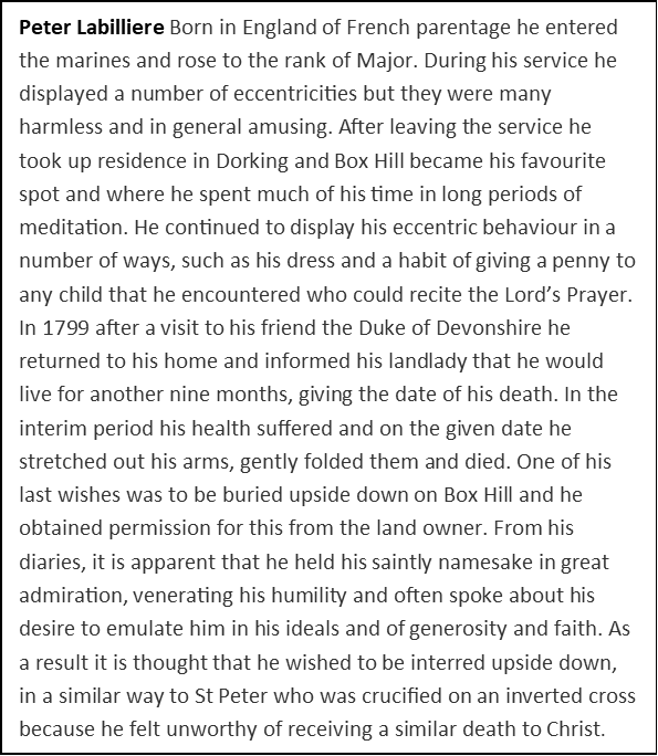
Although they did not find the grave they passed Box Hill Fort – one of a line of 13 mobilisation centres built in the 1890’s to protect London from the threat of invasion from continental Europe.
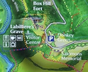
Never used for its intended purpose, it is has fallen into disrepair and is now part of the National Trust Box Hill property. It is also home to three species of bats that have taken up residence in the tunnels originally built for ammunition storage.
As bats are a protected species in the UK the interior of the fort is not open to the public, however you can freely wander around the exterior which is accessible via a public footpath.
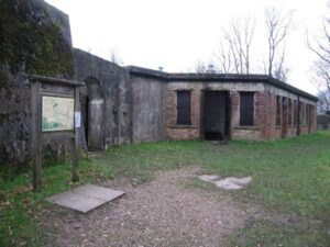
We finally moved on, initially heading east before heading down hill in a northerly direction to Broadwood’s Tower, a flintstone structure built by Thomas Broadwood (a member of the piano-making Broadwood family) to commemorate the Battle of Waterloo. The Tower stands on the hillside overlooking Juniper Hall, once the Broadwood family home and now a field studies centre.
We turned right and continued downhill eventually taking the steps to the track at the valley bottom.
Our intention was then to turn east back towards Headley Heath and its car park. However, we decided to split into two groups for this leg of the journey as Graham and Geoff had planned alternative routes to add interest.
Those that felt up to the challenge would follow the longer and more difficult route, while the others would take the shorter, easier walk back, anticipating a nice cup of tea at the tea hut in the car park while waiting for those who had chosen to tough it out.
Brian, Geoff, Malcolm, Martin and Simon (their route is shown in yellow on the map) set off, crossed the road and immediately had to climb a series of steps steeply uphill. Brian enthusiastically raced ahead but was soon overtaken by everyone else who decided to take the climb more steadily.
At the top they stopped to recover and looked down, hoping to see the others in the valley below but there were too many trees.
Further on they reached a point where the marked route dropped down to Mickleham before climbing back up again. But mindful that they were taking the longer route they decided to cut across the loop and attempt to find the path again further along. Passing a trig point and walking along a pleasant open section they reached the top of the descent down. This was again steep and not easy to stay in control, but it took them back down to the road they had crossed over earlier.
They climbed up from the road and reached the edge of Headley Heath and High Ashurst Outdoor Activities Centre, on the path that would have been used by Graham B and his gang. Not knowing if they were ahead or behind they decided to wait for a bit.
After a while they moved on across the heath towards the car park, expecting to catch them up, but at the car park there were only the cars, so as the refreshment van was still open they decided that a cup of tea was in order whilst they waited.
After a few forays onto the heath, Malcolm decided to text Drew to get an idea when they would be back, but he didn’t seem too sure.
It was at about that time that they realised that the division in the groups meant that none of them had driven and therefore unable to go home or even drive out to pick up anyone who might be injured. They watched the refreshment van pack up and leave, along with most of the cars. Then finally, just as it was getting dark, they saw the first of the other group arrive at the car park, followed fairly rapidly by everyone else.
Graham B led the shorter route accompanied by Drew, Graham H, Laurie, Peter and Phil. They had not been walking for many minutes when they encountered a long, steep climb up to Juniper Top to the east of Broadwood’s Tower – not quite the easy walk they had hoped for, but there was a fine view at the summit.
It was there, as they sat gasping for breath in various states of exhaustion and with Graham H’s early start now telling on him, that Graham B announced that they had missed the turn they should have taken, that would have avoided the climb. It was unbelievable that Graham had made such an error – totally out of character.
After recovering their breath they carried on but within a couple of hundred yards Graham B got his compass out and pointed out that they were again walking in the wrong direction.
They retraced their tracks to Juniper Top and headed directly north down the hill to meet the path they should have been on. Phil’s observation that they had nonetheless enjoyed some good aerobic exercise proved small comfort, while the prospect of an early finish and a cup of tea began to recede.
Undaunted, they pressed on towards Headley Heath, making their way up another steep hill through the grounds of High Ashurst Outdoor Activities Centre in search of the footpath to the car park.
At the top of the hill there was a choice of paths and, as Graham B led the way through a wood, Peter and Phil noticed another track up a very steep hill, thanking their lucky stars that at least they were not going that way. After tramping through the muddy wood for some time they reached a road and not long after Graham B, not without trepidation, made a further announcement.
They had again taken a wrong turn and the quickest way back would be to retrace our steps the half mile back to High Ashurst and start again. It was by then clear that there would be no early finish and no tea.
In an attempt to placate the now exhausted hikers, Graham B suggested that they could telephone the others, who would by now be at the car park, and ask one of them to drive around to pick them up, even if it meant a couple of trips. Everyone thought this a very good idea until Drew helpfully pointed out that all the drivers for the day – and their car keys – were in their group.
Somehow this observation caused a good deal of amusement and, with their spirits raised a little, back they went, only to have to struggle up the steep track that Peter and Phil had been thankful to avoid earlier.
They eventually arrived at the car park as the light faded to be welcomed by various sarcastic and unsympathetic comments from the other group who had been waiting for us for about an hour. So much for the shorter, easier route!
Graham B readily accepted responsibility for the extended walk but, in his defence, it has to be said that in the 50 years he has been our chief navigator you could count the times we have gone wrong on the fingers of one hand. Although at the time we all put it down to him having an ‘off day’ we have now learnt that having subsequently been diagnosed with Diabetes, he was probably ‘not with it’ due to his blood sugar levels being low.
 We drove back to Horsham and had a bit of a rush to be ready for the 7.00pm meal at the China Brasserie in the town centre. The meal was notable for a waiter’s carelessness in spilling four bottles of Tsingtao lager over Peter and Graham B, soaking them. The apologetic manager supplied four free beers and waived the mandatory service charge by way of compensation.
Afterwards most of us adjourned to the Black Jug next door, followed by the walk home and bed at around midnight.
Saturday
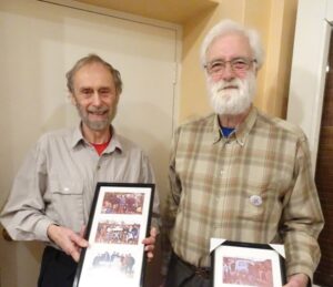 Saturday breakfast time saw presentations being made to Graham B and Geoff to thank them for their sterling work with the planning and organisation during the past 50 years. Without doubt, if it was not for them, we would probably not be celebrating our 50th Anniversary.
There were framed photographs of various groups of hikers of the past, together with a bottle of Graham’s favourite Laphroaig single malt.
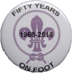
Graham H also issued “Fifty Years on Foot” button badges which we wore with pride.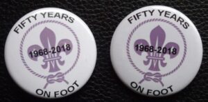
After the ‘ceremonies’ we gathered our gear together and loaded the cars. Everyone except Peter was going to hike – he claimed not to be fully fit and wanted to save himself for the pilgrimage up Leith Hill on Sunday.
It was a fairly long journey to a car park on Devil’s Dyke Road just to the north west of Brighton and close to the Brighton and Hove Golf Club. Although a bit windy the sun was shining as we left the cars in what was a slightly worrying place, close to a travellers site. We walked along the road for a short while before turning south west onto Monarch’s Way.
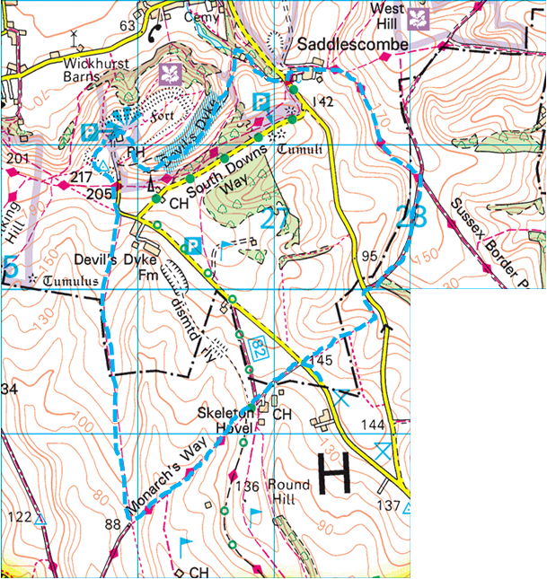
It was a pleasant walk across open undulating downland. We paused only to watch members of the golf club tee off from the green closest to our footpath and to inspect the nearby dewpond, before reaching a path heading north along the ridge towards Devil’s Dyke.
Upon reaching the road we headed north then north west to the trig point and then west across the field to the earthwork where we explored the ruined building believed to be a WWII bunker, before following the path roughly north east to the Devil’s Dyke Inn.
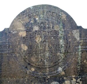 As we were a little early some of us had a look round that included a visit to the viewpoint where there is a commemorative bench. The inscription states that His Royal Highness the Duke of York dedicated the Dyke Estate to the use of the public for ever, on 30th May 1928.
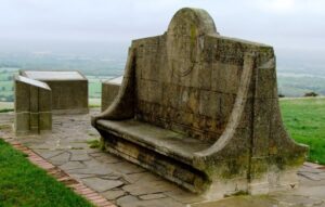
After Peter, who had been exploring the nearby village of Bramber and its castle ruins arrived, we found the large table that had been reserved for us, and enjoyed an excellent lunch.
During lunch the weather had closed in and the bright sunshine of the morning had given way to rain. Although the rain was light as we emerged from the inn at about 1.30pm for a photo of the hikers, it was persistent and steadily got worse during the afternoon. Ever hopeful that the rain might stop Phil and Graham B decided not to don their over-trousers. That was a mistake which they soon came to regret.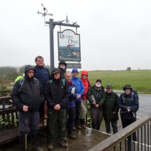
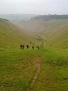
We followed the outside of the pub north then east then south through a little wood (this was because on our map it looked more direct than going through the car park). But as a consequence we had to go down a steep path into the dyke itself.
At nearly a mile long, the Dyke valley is the longest, deepest and widest ‘dry valley’ in the UK. Folklore has it that the Devil dug this chasm to drown the parishioners of the Weald. In reality however, scientists believe it was formed naturally just over 10,000 years ago in the last ice age.
 Like Box Hill, Devil’s Dyke became a huge tourist attraction for the Victorians. It was complete with a fairground, two bandstands, an observatory, and a camera obscura, and it is believed that 30,000 people visited the site on Whit Monday in 1893.
On the way we saw the old concrete footings of the cable car system. Between 1894 and 1909 it operated across the valley, covering a distance of 350 m, suspended 70 m above the valley floor and taking roughly two minutes to cross. It was the very first in the UK.
At the end of the dyke we made our way out onto the downs at Saddlescombe farm and followed the Sussex Border Path east and south east. By then it was tipping it down and the last bit of the hike was really unpleasant.
To add to our misery we had an uncomfortable walk through a field of turnips and fought our way through a very muddy field containing a herd of bullocks that seemed in two minds as to whether to investigate what we were doing more closely before eventually charging off into the distance. Being stuck in mud near twenty to thirty head of beef can be a tad disconcerting. With this ordeal over, we squelched our way back to the cars in the increasing gloom and endured a damp and steamy journey back to Horsham where we could at last dry out.
At this point we said farewell to Simon, who was returning home to Cambridgeshire that night as he was due to take part in a Cyclocross event on the Sunday. We later learnt that he ‘only’ managed 3rd place in his race and says – “I must have left my legs somewhere on the steep slopes!!”
 We enjoyed our Saturday evening meal in Horsham’s excellent Rajkumar Restaurant before moving on for a drink in the nearby Malt Shovel, where there was live music.
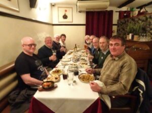
Otter Amber was on draught, brewed by one of Phil’s favourite brewers – the Otter Brewery in Devon.
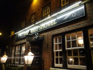 Several of us ordered pints but, disappointingly, the ale had not travelled well from the West Country and whatever they had done with it at the Malt Shovel had not helped. While some of us supped what was probably the worst pint of the weekend we settled down to listen to “Slack Mac” – a sort of Led Zeppelin tribute band.
The band was fine, but after several numbers it became painfully obvious that the venue was too small for their powerful PA system and we therefore beat a retreat to the comparative quiet of the Dog and Bacon, for a decent pint and where at least two of us may have nodded off during what was left of the evening.
Sunday
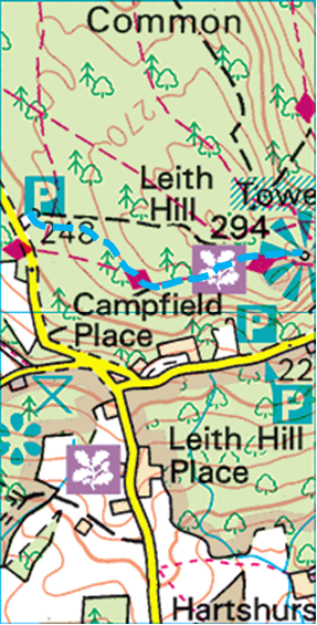
After the usual full English breakfast we packed up, cleared the rooms and left the hotel at about 10.00am. Sunday was the easiest day hiking-wise. We drove in a seven car convoy to Starveall Corner Car Park to the west of Leith Hill.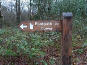
 Although we were about to undertake what was probably the shortest and easiest hike during the past 50 years, it was more of a celebratory occasion, even if Graham B and Phil were the only two of us that took part in the 1968 hike.
We followed the signs and the footpath, albeit rerouted from that shown on the map, and climbed steadily up to the top – a relatively easy walk of about three quarters of a mile to the highest point in south east England and a stark contrast to the steep climb undertaken in 1968 when we approached from the opposite direction.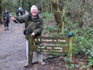
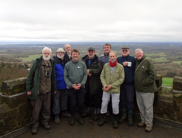
After some of us had enjoyed a cup of tea, all but Brian climbed the Tower to a height of 1,029 feet above sea level.
Leith Hill Tower itself was built in 1765 by Richard Hull, a resident of nearby Leith Hill Place, so that the public could enjoy the stunning views from the top. His remains are buried beneath the Tower.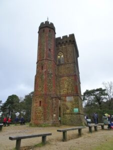
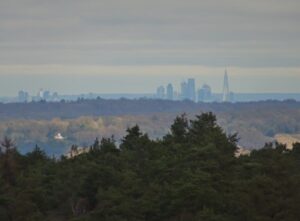 It was a lovely day with superb views over a sunlit London, although to the south the South Downs were in cloud and mist It was possible to make out air traffic using both Gatwick and Heathrow Airports as well as picking out London landmarks such as the arch at Wembley Stadium and The Shard.
After coming down we bade farewell to Graham H, who wanted to start his long journey north.
Although it was quite a chilly January morning, Leith Hill was a very popular place to visit and there were several other day trippers, including a number of joggers and cyclists.
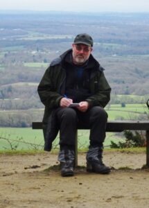 While the rest of us stood around chatting Phil added to the notes he had been making throughout the weekend, which form the basis for this report.
After a gentle walk back to the cars we drove a couple of miles to Geoff’s home village of Forest Green and to his local, the Parrot. We were an hour earlier than our booked lunch but they were able to fit us in – an excellent Sunday roast with a choice of beef, lamb or pork.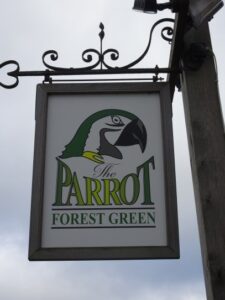
Thus the 50th and final AWH concluded as we said our goodbyes and made our way home. It was a memorable weekend and with the format of our annual get-together changing, the end of a memorable era. It had been PURE GOLD.
As this is the last report to be written, it is perhaps appropriate to include a couple of the comments received after our return home.
- “Thanks for your company during what was, as ever, a very enjoyable weekend in spite of some dodgy weather on Saturday afternoon. I shall remember this year’s hike for the waiters: the clumsy one in the Indian restaurant; the hard-to-please one in the B&B; and the ones who took the long-route option on Friday. The presentations to Graham and Geoff and this morning’s reminiscences at Leith Hill also made it a memorable anniversary hike.” (Malcolm)
- “It was really good to see so many able to stay for the celebratory Sunday lunch. With representatives from all eras of the winter hike, I felt that it was a fitting end to 50 years. Also payback for all those long trips home from northern hikes in previous years.” (Geoff)